Site Map for a Country Show
This was a map created for Moreton Show, an agricultural show at Moreton In The Marsh in the Cotswolds. There were two versions of this map created at two different scales: One at A0 for onsite display boards to help visitors locate themselves and one at A4 to be printed in booklets and handed out to help visitors find their way around the site. This particular version has the exhibition stands numbered in bold for cross reference with the index in the show guide books.

Map insert for a book
This map was created for a publisher. They were putting together a biography that mentioned several places in a specific area and the routes between those places. They wanted the map to be monochrome and they wanted the routes and locations mentioned in the book to stand out above the general surrounding features.

Museum Display Map
An excerpt from an A0 sized display map for a museum. The purpose of this map was to show the general area where Anglo Saxon Brooches had been found across Oxfordshire. The base mapping was styled to appear similar to the old OS Landranger ‘inch to the mile’ maps.
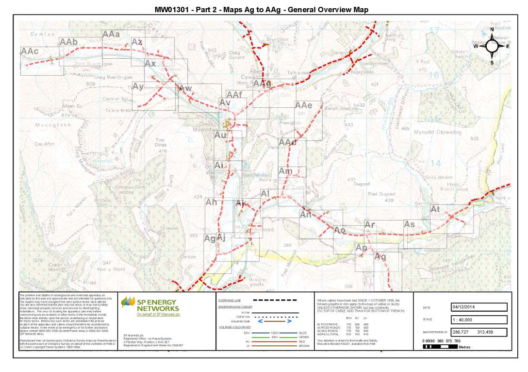
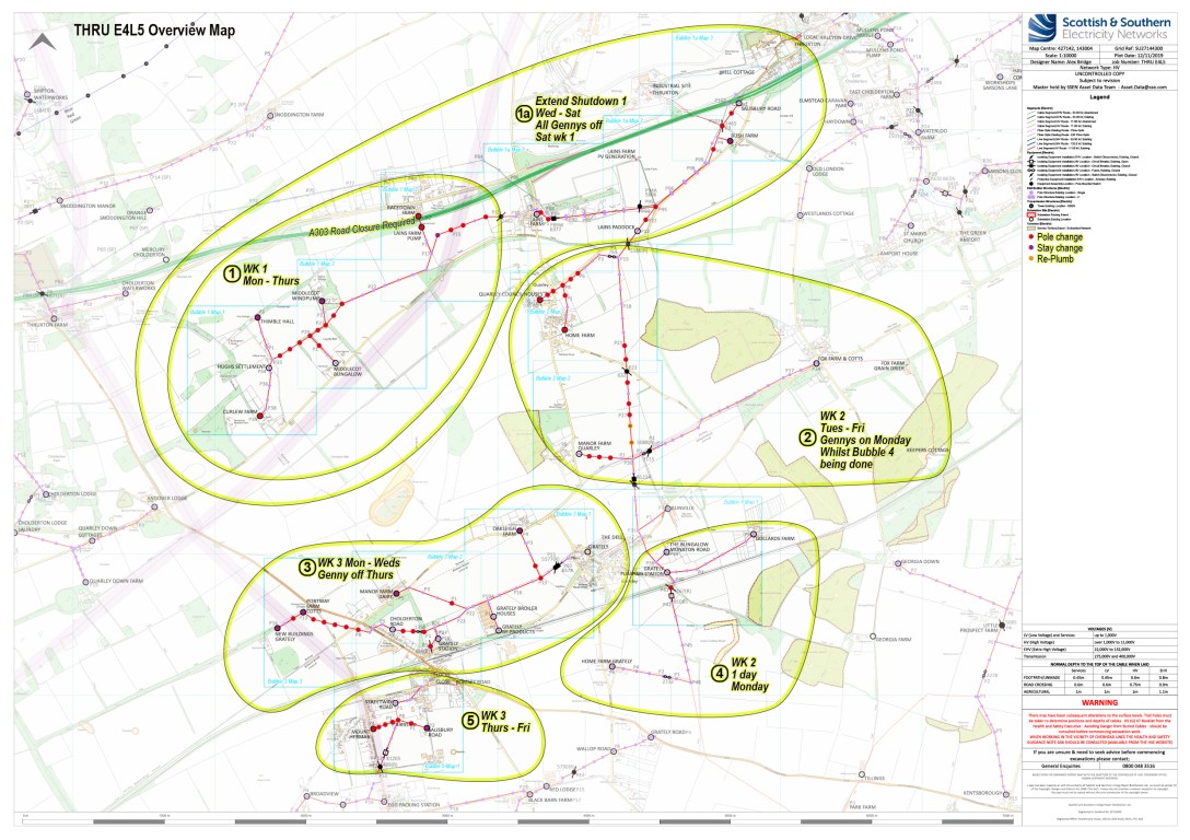
Annotated GIS Map
A pdf map generated from the clients own GIS mapping server and annotated according to their specifications. These maps are used as planning and briefing documents in the utility industry.

Hotel Location Map
An A4 sized location map for a hotel. The primary function for this map was to help people find the hotel once in the local area. The secondary function was to show guests the beauty of hotel surroundings. Hill shading has been employed, to bring a real sense of the form of the landscape.

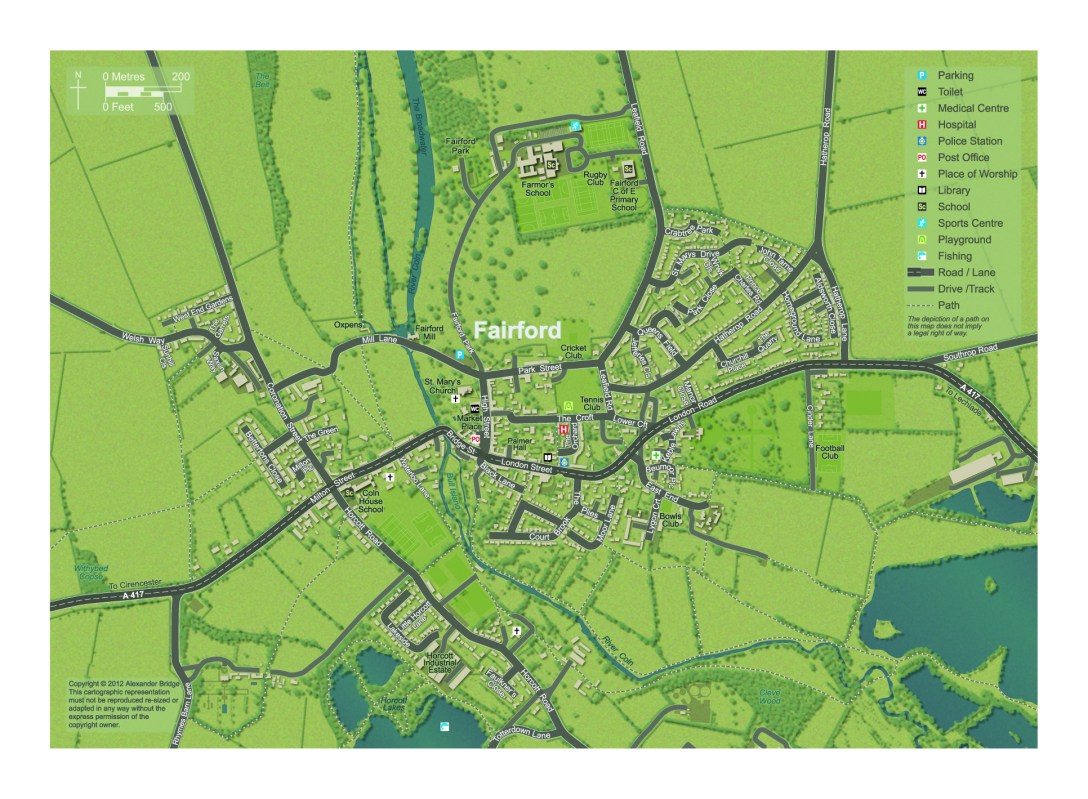
Town Map
A map for a local information magazine. It was designed to give people an overview and to encourage visitors to explore the town and it’s surroundings.
Orienteering Map
A map created in official British Orienteering Federation colours for a school orienteering course.

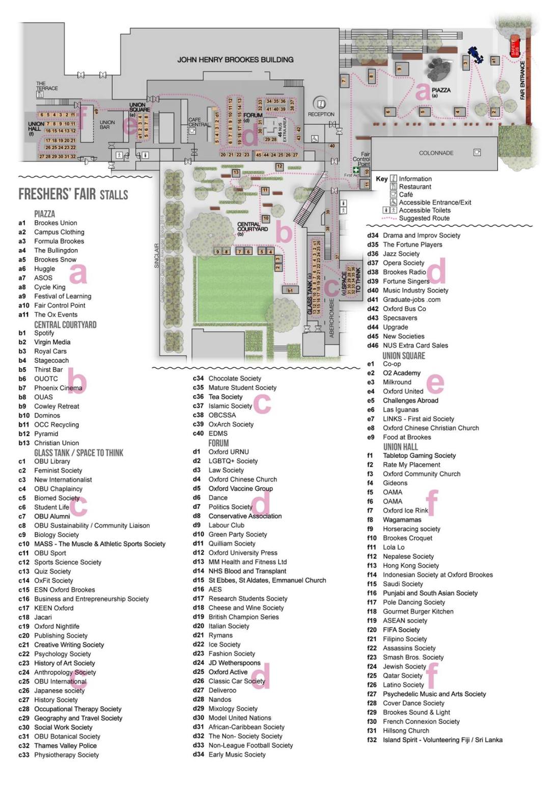
Fresher’s Fair Map
An A3 sized map for inclusion in a University Fresher’s Fair leaflet. The purpose of the map was to illustrate the location of the stalls, index the stall-holders and encourage students to move around the entire fair.
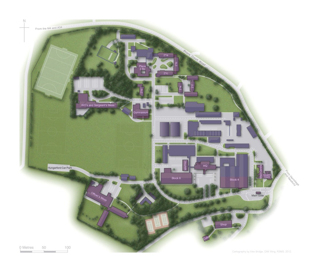
Site Map
A map created to help people quickly orientate themselves and find their way to the right building once on site.
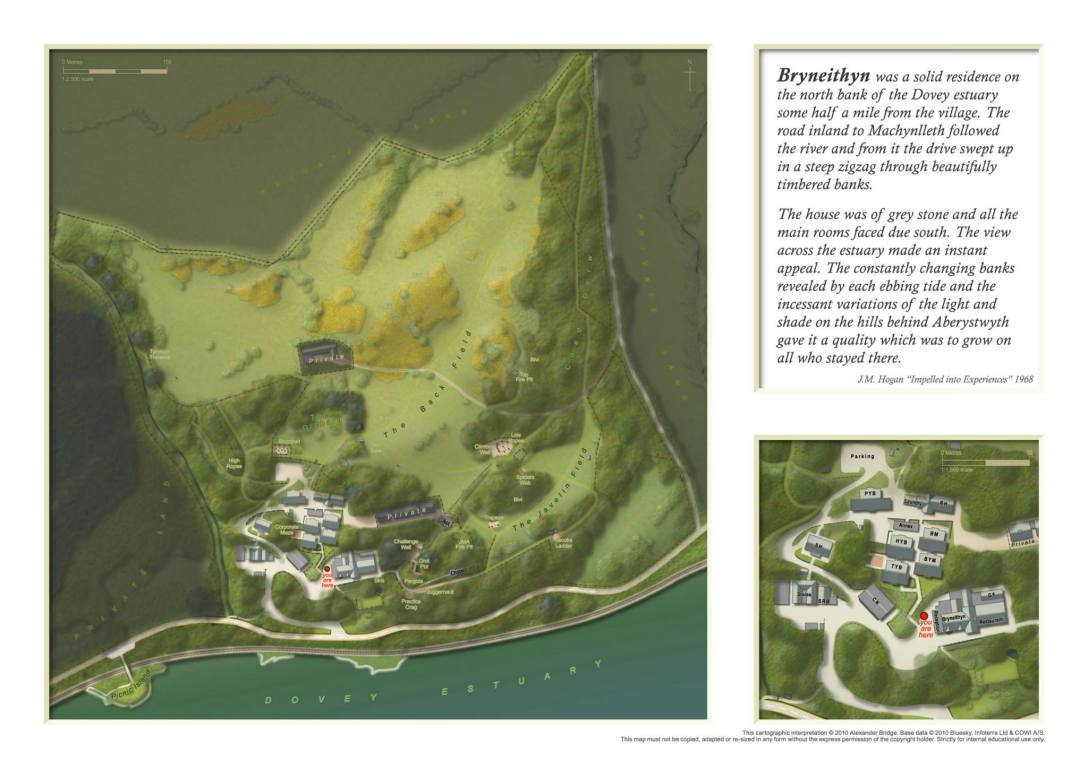
Site Map
A map created to show visitors where they were standing in relation to their surroundings, to give them an overview of the site for navigation and to show off the natural beauty of the area.
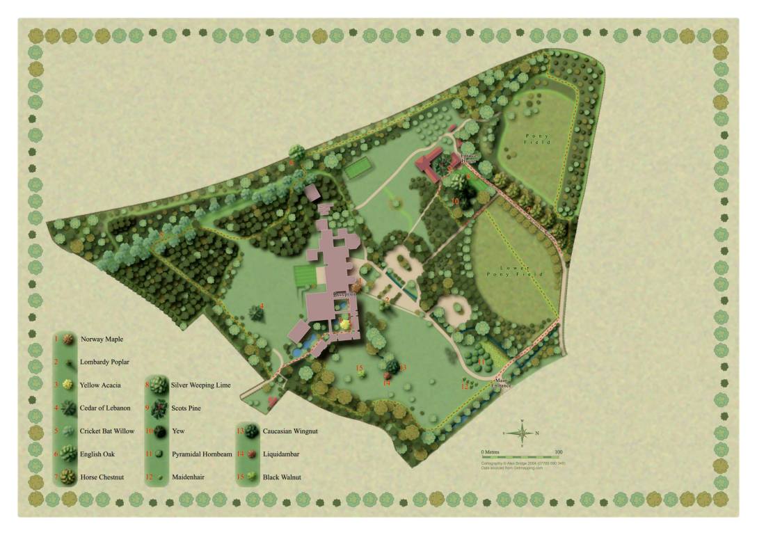
Site Map
A map created to illustrate a footpath around these beautiful grounds with a particular focus on the variety of notable trees to be seen along the way. Areas of the page were left blank ready for the client to insert their own text.
Atlas Map Pages
All aspects of the Atlas of Vernacular Architecture of The World were planned, designed and laid out cover to cover, ready for printing and publishing, including the creation of over 70 thematic maps.


